|
Name
Location
Region
Description |
| Name | Location | Region | Description | |
| Old Quarry | -2013, 2081 | Desert of Shades | ||
| The Squiggle | -1900, 1852 | Desert of Shades | ||
| The Fault | -294, -575 | Fool's Paradise | A rift along a fault line | |
| House of Heroes | -1599, 877 | Fool's Paradise | Ruins on top of a hill | |
| Old Fish Farm | -2973, 783 | Fool's Paradise | Many ponds like they use to raise fish | |
| The Blue Lake | 1210, -948 | Karnak | North of the School of Thought | |
| Boomerang Hill | 650, -1500 | Karnak | ||
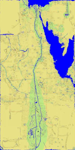
| The Crater | 164, -139 | Karnak | Most likely created by a prehistoric meteor strike, this stunning area is filled with flora and fauna. It was once believed that the meteor deposited much iron in the area but no special vein has ever been located. Ruins in the area indicate that the crater has been previously inhabited by many people. | |
| DOG Pound | 2475,-1600 | Karnak | Home of the guild Dis Ol` Gang | |
| Keyhole Lake | 1300, -4487 | Kush | Once the site of an ancient forge | |
| Kushy Paradise | -2000, -2900 | Kush | At the western end of Kush | |
| Lotus Lake | 656, -4363 | Kush | Branched off from the western fork of the Nile | |
| Pacman Lake | 884, -3019 | Kush | It has a ship docked in it | |
| Pharaoh's Playground | 926, -3910 | Kush | ||
| Route 66 | 274, -4089 | Kush | Starts south of the University of Thought in Kush and goes all the way west, also known as "White Hills Wilderness Trail" | |
| Suburia Gorge | 1427, -3621 | Kush | A gorge filled with equally sized lots | |
| Heqa Lake | 1799, -3634 | Kush | ||
| Cresent Lake | -829, -2593 | Kush | ||
| Circle Road | 1189, -4831 | Kush | ||
| Pappyland | 858, -4870 | Kush | ||
| Mirage Hills | -1446, -2578 | Kush/Fool's Paradise | ||
| Nubian Oasis | 965, -3200 | Kush | ||
| Eastern Desert | Kush/Khartoum | The large expanse of desert that covers the eastern expanse of Kush and Khartoum | ||
| Western Desert | Kush/Khartoum | The large expanse of desert that covers the western expanse of Kush and Khartoum | ||
| Horseshoe Mountain | -363, -5386 | Khartoum | Horseshoe shaped mountain, also called Khartoum Caldera. | |
| Khartoum Caldera | -363, -5386 | Khartoum | Horseshoe shaped mountain, far northwest of the CS. | |
| Khartoum Volcano | 380, -6508 | Khartoum | Generally a papyrus-growing site, south of SWorship. | |
| Setna's Spiral | 1080, -7572 | Khartoum | A perfect spiral, east of the southern schools. | |
| Ye Olde Slate Mines | 336, -7660 | Khartoum | A huge pit filled with orange dirt, once the site of an extensive slate-mining operation. | |
| Four Square Point | -404, -6072 | Khartoum | An oddity: four ponds, surrounding a centerpoint. Possibly the old location of a University. | |
| The Putting Green | 296, -5244 | Khartoum | A perfect spot for a round of golf or two. | |
| The Scab | 1824, -7660 | Khartoum | An odd, exposed mountain range in the midst of nowhere... | |
| Ship of Fools | -2980, -8108 | Khartoum | The far southwest corner, holding a 'ship' out in the middle of nowhere - and a nice valley. | |
| Sunset Valley | 48, -5864 | Khartoum | A wide valley, carved out of the landscape and home to several guilds across various times. | |
| Otter's Molehill | 1096, -6168 | Khartoum | A black mountain covered primarily by roads and twists, and a real pain to climb up... | |
| Royal Palm Heaven | 708, 5245 | Lower Egypt | A whole lot of Royal Palms on a small patch of road | |
| The Ampitheater | 1385, 5645 | Lower Egypt | Looks like a natural ampitheater | |
| ! Lake | 1230, 5050 | Lower Egypt | Looks like a ! | |
| Lima Bean Island | Lower Egypt | Home of Ktisibios the Greek | ||
| Lolli Crater | 1200, 7100 | Lower Egypt | Named for the Lollipop Guild | |
| Pappy Mountain | 964, 6246 | Lower Egypt | ||
| Pi Bridge | 900, 6600 | Lower Egypt | A bridge across the nile at the intersection of three roads in the shape of the greek letter Pi. | |
| Pinky | 285, 6190 | Lower Egypt | A large hill of a pinkish hue. Also know as Mount DOOM | |
| MOUNT DOOM | 272, 6148 | Lower Egypt | A large reddish mountian. Also known as "Pinky" | |
| Sunset Pond | 1015, 6935 | Lower Egypt | ||
| Fred the Cat | -672, 6566 | Qatara | A giant stone cat | |
| Arcadia Island | 805, 1034 | Seven Lakes | The large island in the Nile in southern Seven Lakes. Named for the guild | |
| Caldera, 7 Lakes | Seven Lakes | Southwest of the University of Thought | ||
| The Land Bridge | 934,1337 | Seven Lakes | Southwest of the University of Leadership / Nile Crossing | |
| The Evil Mountain | 1160, 1575 | Seven Lakes | Named for the evil of getting around them | |
| Esquine Lake | 1600, 1936 | Seven Lakes | Named after a guild | |
| Necklace River, East | Sinai | Feeds into Pendant Lake | ||
| Necklace River, West | Sinai | Feeds into Pendant Lake | ||
| Pendant Lake | 3235, 4838 | Sinai | North of the Chariot Stop, "hangs" from Necklace Rivers | |
| Razor's Edge | Sinai/Cradle of the Sun | The strip of land that connects Sinai and Cradle of the Sun on the edge of the world | ||
| Barrier Mountains | 1450, 3730 | Upper Egypt | Blocks the route along the east side of the nile | |
| Cat Paw Lake / Clover Lakes | 1660, 3515 | Upper Egypt | Known as Clover Lakes by the people who live around them and the Windward Ways Guild | |
| Liberty Bridge | 1275, 4018 | Upper Egypt | Named for the sculpture of the Statue of Liberty that once stood there | |
| Paradise Plains | 2049, 3666 | Upper Egypt | ||
| Phoenix Public Park | 2282, 2270 | Upper Egypt | Location of a major public park in T2, named after the Phoenix Pole that stood there. | |
| Phoenix River, East | 1540, 3085 | Upper Egypt | Added when people moved closer to the chariots | |
| Phoenix River, West | 1160, 3140 | Upper Egypt | Named by Pheanor of PRISM (Phoenix River Incorporated for Sharing Machinery) | |
| PRISM Altar | 2317, 3185 | Upper Egypt | Named for the guild PRISM, which is no more. Site of many of the Festivals in T2, T2 Worship monument nearby. | |
| Horus Bridge and Horus Altar | 1450, 2805 | Upper Egypt | Named for the Horus Tears Guild | |
| Tortuga | -1240, 4767 | Valley of the Kings | A giant tortoise | |
| River Gorge Road | -1709, 4434 | Valley of the Kings | ||
| Path of Light and Dark | 2144, 7701 | Tanis | Official road sign pointing east | |
| Lake of Reeds | 4150, 6500 | Tanis | The lake and river along the northeast of Egypt. For more info, see this page. | |
| River of Reeds | 4250, 7250 | Tanis |