Lower Nubian Mineral Map
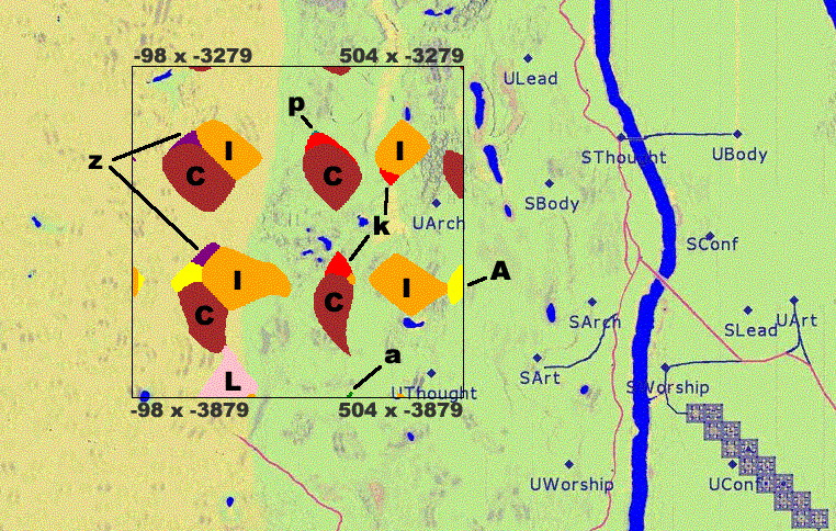
I created the above picture using a huge 4096 x 8192 sized map of the Tale 2 Egypt that I found online. Basically, I parsed the text document and pulled out specific location information based on the formatting of the text file. That information was then plotted onto the map by converting the Tale 2 coordinates to a XY coordinate system. Hope it helps!