Proposed Plan of Action
- Build the pump
- Initial tower on either side of the river
- Build the first 25 towers out to and including the splits, taking into account people's compounds and high ground, upgrading the pump, adding towers and upgrading existing towers as we go
- Assist the four target regions - ND, PB, VoK, Sinai - as much as possible to complete each of their lines, and continue raising the pump and towers until there is sufficient height for water to reach the furthest planned tower
Old Maps:
- We are planning to build a pump at the below location.See map at Fair Deal West
- See detail map at The Narrows. Main Tower branches North of Pump.
- Alternative Sites at higher altitudes.
- One way to Sinai can be found at Sinai Water Works
- Proposed Western Route Proposed Western Route.
- Slight changes to Proposed Western Route. PB branch is nearer to pump. Proposed Western Route2
First proposal to PB VoK. Since ditched for Proposed Western Route.
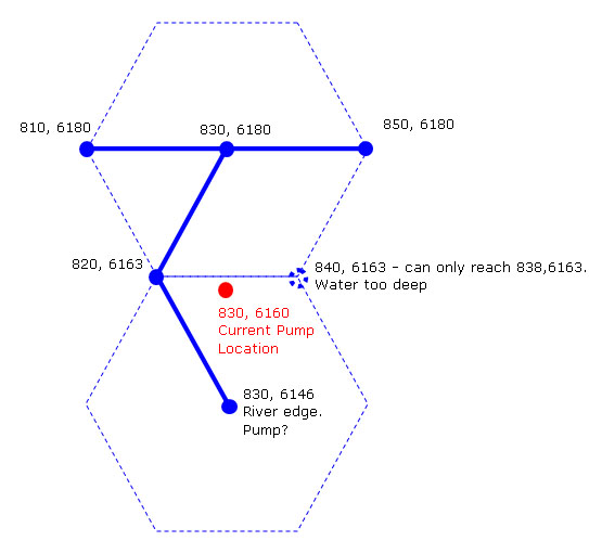
Picture of pump location on a hex-grid. Red is currently proposed coordinate (830 6160) which is not in a hex grid with 830,6180(branch to PB). and 850,6180(branch to Sinai). Solid blue is possible aqueduct links.
Unfortunately, 830, 6146 only offers a water tower, not a pump... - Bifa
Proposed Alternative Narrows Route. This is assuming that cannot branch off North from pump.
Have been disregarded after confirmation that pump to first tower doesn't need to be in hex-grid.