Harmony Ridge Route
|
|
*Location*
Altitude
Notes |
- This route begins directly across the Nile from the UHarmony
- Follows Harmony Ridge for 18 Towers with the highest point at 295 feet under the 14th Tower
- Continues northeast across to the SBody
- Goes northwest across the ridge, where it has to clear 113 feet under the 52nd Tower
- Zigzags north through the pass and then west to The Goods
- Shoots the gap between the SHarmony and SArch with a Tower only 9 feet tall (5 is the minimum)
- Ends in mixed sand and grass on the banks of the Nile, heading north.
Elevation is Important
The 61 foot elevation near the UArch is actually the controlling elevation and requires that the pump be 396 feet high which also gets us into the optimal mixed sand and grass growing areas at the end of the aqueduct on the banks of Nile, north of The Goods and the UArch.The base elevation of the initial portion of the route averages 200 feet in base elevation, and the remainder of the route takes advantage of several other ridges. Rather than an average tower height of 400/2 = 200 feet, which would be the case on flat land, our average tower height is only 142 feet. As tower costs are linear with height, and as our average base elevation is 58 feet, intelligent routing is paying for 23 of the aqueduct towers.
The math is brutal. Pump cost varies with the square of the elevation, and you need 5 feet of additional pump height for each additional Tower. Plus, every time you add a tower at the end of the line all of the previous towers must become five feet higher, which is also a squared function although it's distributed. You don't want to get carried away and build too many towers.
- Every time you increase the number of Towers by 41%, your overall costs double.
- The Harmony Ridge Route is designed to support 80 towers, with only 4 feet of margin near the UArch.
- 80 towers + 80 towers -> 80^2 + 80^2 = 12,800 units.
- 113 tower aqueduct -> 113^2 = 12,769 units (41% more towers per aqueduct would double the price)
The base elevation is important, because it reduces the build height of the tower. The top of the tower decrements by 5 feet each time (water always flows down hill) so you want to have high ground at the beginning of the route, and low ground at the end of the route.
- To clear 295 feet on the 14th tower, up on Harmony Ridge, the Pump needs to be 355 feet high.
- To clear 113 feet on the 54th tower, near the SBody, the Pump needs to be 375 feet high.
- To clear 61 feet on the 68th tower, near UArch, the Pump needs to be 395 feet high.
The Pump Location and all of the tower locations have been verified using the Aqueduct Widget. The critical elevations were measured using a Q8141 Barometer, so they are accurate, but we'll want to check everything again after we build the first few towers, to tighten up on all of the requirements and to make any final adjustments.
Soil is Important
Mixed sand/grass is also very important. All (or at least most) towers are associated with a particular type of Veggie, and if you don't have the right soil you've missed an opportunity. You don't want a Tower that's just on sand, because there's no possibility that it will be able to grow herbs. Moss doesn't seem to care.The route is planned so that the end-of-line towers are in mixed sand and grass, along the Nile north of the UArch and near The Goods, so that everybody who grows veggies for sale contributes to our success.
Prior Development is Important
You'd be crazy to build a tower right in the middle of somebody's camp or compound, so you also have to keep an eye out for existing developments. You want the Towers to be convenient for growing veggies, but not smack in the middle of everything. We've contacted everyone who is likely to have a Tower in their backyard, with the exception of one recent player who has not been in-game for a month.Getting across roads is really difficult. Players can't build anything, including an aqueduct tower, near a road or a system sponsored building. Also, roads seem to attract compounds which further restricts the feasible crossing points. Our initial plan was to have a Tower adjacent to The Goods. What we got, instead, was a good illustration of how difficult route planning can become. The Tower location nearest to The Goods is right in the middle of their compound. Of the adjacent 6 tower location, 3 are blocked by roads, and the only other route in the area has to traverse a decent sized hill to sneak past the SHarmony. If you're afraid you missed out on all the fun, bring your Aqueduct Construction Site widget to The Goods, and run a survey. Lots and Lots of constraints.
In Tale 2, drinking water from a Tower was a nice way to get a 24 hour boost in your stats. You can use the temporary boost to trim out your Strength/Dex for carry, or you can use the perception boost to make prospecting for Metal Ore, Marble, and Tooth Limestone a bit more efficient. Surprisingly, the stat boosts are nearly as important as the increased (doubled) veggie yields.
Route Review
We've placed small chests to mark the route or, more particularly, to verify that things can actually be built where the Aqueduct Widget says you can build a Tower. There's plenty of room to build a kitchen compound adjacent to the pump.The technical and social details for this route have all been worked out, and now we can wait to see what else pops out of the woodwork.
The attached Excel spreadsheet contains the same data, with some derivative calculations.
| *Location* | Altitude | Notes |
| 1028 1575 | 0 | Pump, south of UHarmony |
| 1049 1575 | 41 | End, grass but no bonus |
| 1060 1558 | 144 | End, no grass or sand |
| 1080 1558 | 199 | |
| 1090 1540 | 162 | |
| 1110 1540 | 219 | |
| 1130 1540 | 225 | |
| 1150 1540 | 221 | |
| 1170 1540 | 184 | |
| 1190 1540 | 191 | |
| 1210 1540 | 237 | |
| 1220 1558 | 256 | |
| 1240 1558 | 294 | Highest point on the route |
| 1260 1558 | 250 | |
| 1270 1575 | 159 | |
| 1280 1592 | 136 | Grassy slope |
| 1300 1592 | 126 | |
| 1320 1592 | 56 | |
| 1340 1592 | 24 | Crosses road |
| 1360 1592 | 18 | |
| 1370 1610 | 57 | |
| 1380 1627 | 109 | |
| 1400 1627 | 152 | |
| 1420 1627 | 95 | |
| 1440 1627 | 54 | |
| 1460 1627 | 23 | |
| 1480 1627 | 8 | Sand, grass, near Hoteph, chest |
| 1490 1610 | 9 | Sand, grass |
| 1500 1592 | 5 | |
| 1510 1575 | 5 | |
| 1530 1575 | 15 | |
| 1550 1575 | 14 | |
| 1560 1592 | 14 | |
| 1570 1610 | 116 | Jump up on the plateau |
| 1590 1610 | 9 | |
| 1600 1592 | 6 | Near an empty Nile Sunrise compound |
| 1620 1592 | 6 | Near the road, but it works |
| 1640 1592 | 7 | |
| 1650 1609 | 6 | Nearly in the lake |
| 1670 1609 | 0 | Next to the Raeli Oven |
| 1690 1609 | 2 | Sand and grass, near Kiyye |
| 1700 1627 | 28 | Sand |
| 1710 1644 | 132 | Sand on Ridge |
| 1700 1662 | 91 | The top of the ridge would be 223 feet |
| 1690 1679 | 69 | |
| 1680 1696 | 41 | |
| 1670 1714 | 87 | We own this compound now |
| 1680 1731 | 74 | Near SBody |
| 1670 1748 | 78 | |
| 1660 1765 | 120 | The pump must be at least 365 feet high |
| 1650 1783 | 106 | |
| 1630 1783 | 37 | Crosses the road |
| 1620 1800 | 6 | |
| 1610 1817 | 4 | |
| 1600 1835 | 60 | |
| 1590 1852 | 68 | |
| 1579 1869 | 15 | |
| 1559 1869 | 6 | |
| 1539 1869 | 10 | |
| 1519 1869 | 3 | |
| 1509 1886 | 9 | |
| 1500 1904 | 3 | |
| 1490 1921 | 9 | |
| 1480 1938 | 11 | |
| 1490 1956 | 11 | |
| 1500 1973 | 20 | |
| 1509 1990 | 61 | This tower requires a Pump height of 395 feet |
| 1499 2008 | 32 | |
| 1479 2008 | 36 | |
| 1459 2008 | 10 | Crosses the road between the SHarmony and UArch |
| 1439 2008 | 10 | |
| 1429 2025 | 14 | |
| 1420 2043 | 0 | Actually in the water, but it works |
| 1430 2060 | 5 | Sand |
| 1440 2077 | 5 | Sand and Grass |
| 1450 2094 | 6 | Sand and Grass |
| 1460 2111 | 11 | Grass |
| 1470 2129 | 12 | Too high for the final 5 foot tower |
The Harmony Ridge Route has a huge cost advantage, because individual tower costs are linear with height (and 2nd order overall because all of the previous towers have to get higher) and we're using about 200 feet of mountain that's already there as the base elevation for the first dozen (highest) towers. That means we'll be able to make the line much longer for the same price.
Tower and Pumping Station Grid
The geometry of the Tower Grid is nicely diagrammed at http://perl.atitd.wiki/tale2/Buildings/Aqueduct_Water_Tower.Towers are connected in a hexagonal grid by Pipes that are 20 coordinates long. The grid is predetermined.
- Running EW you'll get a tower every 20 coordinates.
- The tower location is always centered on a xxx9-xxx0 boundry.
- Alternate rows are staggered by 10 coordinates.
- Running NS you actually have to use a zigzag pattern
- The vertical dimension is 20*Sin(60 degrees) = 20*Sin(Pi()/3) = 17.3205 coordinates.
- That's +/-10,+/-17.32, so you'll get a tower every 34.64 coordinates if you're going straight NS.
- The vertical grid probably starts at 0, but it's easier to just eyeball it as 17.32 doesn't fit the coordinate grid.
Horizontially, the tower widget repeats every 20 coordinates, and reads:
- Far (for 2 coordinates)
- 128-9 feet (for 7.5 coordinates)
- TOWER for 16 feet (1 coordinate, exactly centered on an EW coordinate boundary)
- 9-128 feet (for 7.5 coordinates)
- Far again (for 2 coordinates
Vertically you'll get the same countdown pattern, except that the straight vertical distance is 34.4 coordinates, so each of the Far indicators are 4 x 9.32 coordinates.
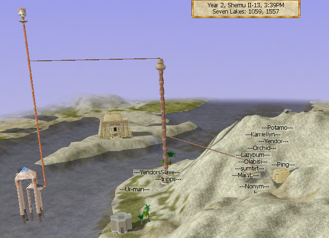
If the tower widget would otherwise be reading Far, AND you are within 1.5 coordinates of deep water (we've only tested this for Pumping Stations along the Nile in Seven Lakes), the tower widget will read Aqueduct Pumping Station. Deep water is visible as a shadow at certain times of the day, or as a deep channel that comes very near the shore, and it's usually difficult to climb the bank at that point if you are swimming.
The largest plat we've found so far, just south of the bridge near the Seven Lakes UThought, is 3 coordinates wide by 18 coordinates long, which is very nearly the entire range (4 x 18.64) of the far indicator on the tower widget, thereby demonstrating that an Aqueduct Pumping Station isn't at all hard to find if you're near deep water.
| Unused Pumping Stations | Comments |
| 1460 2478 | |
| 1464 2413 | SE corner of Clay/Dirt area |
| 1460 2408 | Large plat |
| 1460 2345 | Just SW of bridge |
| 1462 2328 | Huge continuous plat |
| 1482 2228 | On the point south of the lagoon |
| 1480 2224 | Large plat covers most of the point |
| 1136 1705 | |
| 1139 1711 | Large plat |
| 1233 1792 | |
| 1251 1757 | |
| 1447 2104 | |
| 1459 2127 | |
| 1467 2138 |